
 The old Chickasaw Cession survey maps in the Itawamba County courthouse show the Natchez Trace route as it appeared when the surveyors mapped out the Chickasaw Cession during 1834. Back then the ancient road was labeled as The Old Natchez Road. The story of the Natchez Trace is a fascinating story of the frontier South. It is the story of circuit riding preachers, missionaries, bandits, land pirates, soldiers, slaves and settlers. It is also the story of the Chickasaw, Choctaw and Natchez Indians.
The heaviest use of the Old Natchez Road was from 1800 to about 1825 by men known as "Kaintucks," who floated down the Ohio and Mississippi rivers with their goods to Natchez and returned north on foot using this old trail from the 1700s that was developed into a Federal road shortly after 1800.
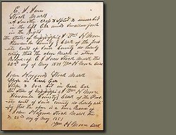
The old 1834 survey maps of what later became Itawamba County in 1836 show this old road in detail. One such small section of a map (illustrated above) shows The Old Natchez Road and also Factor’s Field along the road. Old Factor’s Stand was a resting place in the heart of the Chickasaw Nation where travelers could obtain room and board on their trek between Natchez and Nashville.
During 1811, Samuel Hastings Stackhouse traveled down the Natchez Trace to Natchez. On Monday, November 25, 1811 he wrote the following about the area of Old Factor’s Stand: “Start early. Continues raining during the fore part of the day. Stop at the Old Factor, a respectable Indian who takes his name from being the principal manufacturer of homespun in the nation & appears to have a large settlement… After baiting our horses proceed on. Observe the country tolerably well improved, Indian plantation every few miles. Arrive at the Big Town which formerly contained many buildings but is now hardly anything more than an extensive prairie with some scattered huts, the Indians having left the town for situations better adapted to agriculture… The two last days we pass through considerable pine barren & over several large streams of water. Some that we have crossed today we calculate to be the head waters of the Tombigbee1…”
The following year, Reverend John Johnson (born January 7, 1783 in Louisa County, Virginia, moved to Tennessee during 1803, married Susannah Brooks, died April 8, 1857), a Methodist-Episcopal circuit rider and missionary in Ohio, Illinois, Kentucky, Tennessee and Mississippi rode through what later became northwestern Itawamba County, spending the night near Old Factor’s Stand near Twenty Mile Creek. He was headed from Natchez to Nashville where he had overseen the Natchez Circuit during the previous year. He wrote in his journal: “I have this day swam my horse 5 times, bridged one creek, forded several others, besides the swamp we had to wade through. At night we had a shower of rain – took up my usual lodging on the ground in company with several Indians2.”
Further information about Johnson’s journey is found in a letter he wrote from Natchez to family in Nashville on November 28, 1811. Telling of his journey to Natchez he wrote: “Dear Mother, Brothers and Sisters: - I must write to you collectively, as I cannot individually. It is with pleasure I inform you that I enjoy health of body, and in some degree, quietude of mind; and that we had a safe and somewhat comfortable journey to this place. We came through with post haste, occupying only nine days and seven hours in coming through the nations. Came forty miles or upward each day. Our horses performed the journey well. We reached the Territory on Wednesday, the 20th instant. I find it easy to speak of, but very tedious and tiresome to make a journey of five hundred miles. The road is far better than I expected to find it. The friendly clouds poured down one heavy shower of rain upon us in the wilderness, and but one. The Indians are very kind and friendly; sold us corn at $1 to $1.50 per bushel. I think the Indians are far better than some of the whites who are among them3…”
The story of Old Factor’s Stand in the area that later became Itawamba County is but one story told along this old Federal road connecting Nashville to Natchez during the frontier days of the Mississippi Territory in the old American southwest.
Endnotes
1Carolyn F. Castor, “Travel Diary of Samuel Hastings Stackhouse, 1811,” Early Southwest Mississippi Territory, http://www.natchezbelle.org/sw/diaryintro.htm (accessed March 30, 2009).
2Nostalgiaville Publishing, “Images from Nostalgiaville: Mississippi – Natchez Trace Parkway,” Nostalgiaville, http://travel.nostalgiaville.com/Mississippi/mississippi.htm, (accessed March 30, 2009).
3Susannah Johnson, Recollections of The Rev. John Johnson and His Home: An Autobiography (Nashville, TN: Southern Methodist Publishing House, 1869), 70.


4 comments:
Thanks, Bob, for putting together this wonderful slice of history. I enjoyed it very much.
Thanks for the comment Mona. I've always been fascinated with the Natchez Trace. Such a rich and colorful history spanning three centuries are along that old road.
Thanks for your article about the Trace. My family enjoys the Natchez Trace very much. We have taken several day trips up and down, stopping along the way to hike the trails and take in all the little adventures along the way. From my home it is just as easy to take the Trace to Jackson, MS as it is to go to Memphis and get on the interstate. We also take it to Nashville, getting on at Lawrenceburg. It is such a peaceful drive too. I take the Trace at every opportunity.
Bob ... Fascinating!
Post a Comment